Kitt Prible wrote to us to tell about his unique use of X-Plane 11. In his own words, here he tells us about his experience recreating Amelia Earhart’s final voyage in X-Plane 11:
My head is still in the clouds, but my feet are on the ground after landing last week and completing a recreation of Amelia Earhart’s round the world trip in X-Plane.
I still can’t believe it. I flew around the world on a shoestring budget – not bad for a retired guy who didn’t know how to fly 2 years ago. Cindy (my wife) bought X-Plane 11 for me when I retired. I fell in love with it but quickly discovered I needed to learn how to navigate once I flew far enough away that I could not no longer see the airport to come back and land again.
On January 29, 2020 I completed Amelia Earhart and Fred Noonan’s trip around the world. It took Amelia & Fred 48 Days to get to Howland Island (85% complete). It took me 212 Days to go completely around the world. I took longer as I was helping Cindy watch her 95-year-old mother who has been bedridden for the last 9 months and living in our home for the last ten years.
I watched a lot of YouTube videos as I went along. I got a little better at flying/navigating and decided to try out some car trips we have made on vacations and recreated them. That was when the idea to recreate Amelia’s trip came upon me.
I boned up and read several books about her trip including extensive log notes she kept. I used those to recreate the weather and flight altitudes she took to make it realistic. I created a spreadsheet of her route and looked up all the airports they landed. Many don’t exist anymore, so I chose the closest one I could find. It got challenging as I went further east and the names changed with the foreign languages adding difficulty to the research required for the trip planning. I can only imagine what this was like for Earhart & Noonan as they did not have Google Maps back then and they too had limited resources to plan the route, get government clearances and to supply fuel and technical knowhow to several key landing choices.
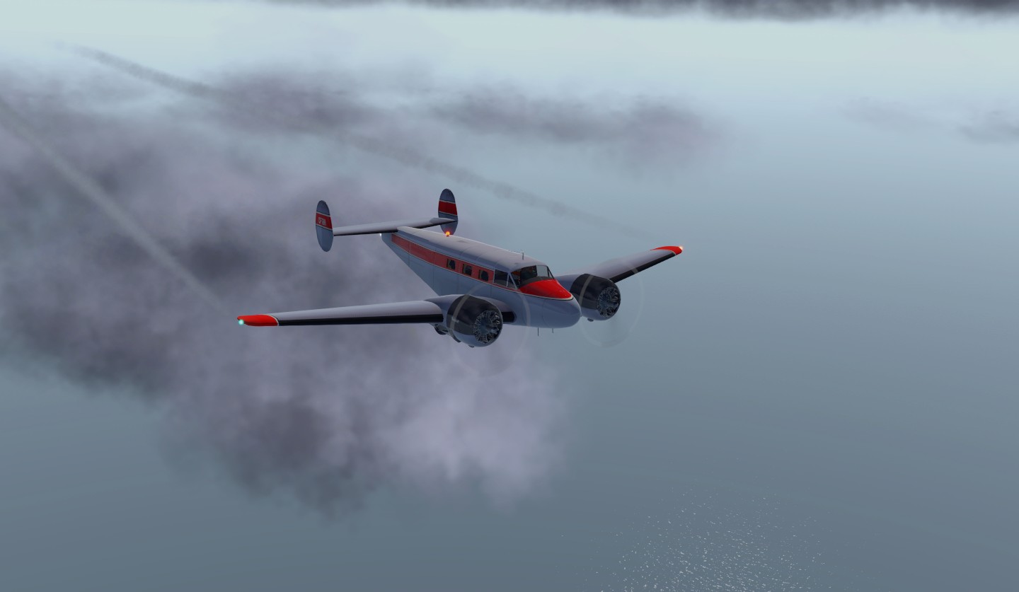
I started out with the King Air 350 from Airfoillabs. It was a wonderful experience, but friends and relatives kept saying, that’s not the Electra. Correct, but it flew 100 knots faster and Amelia was not watching her 95-year-old mother. I tried to find a decent Electra to fly, but they were not all that realistic looking. I finally found a Beech 18 taildragger from Shade Tree Micro Aviation and it was a very close find. 100 hp less on each engine than the Electra and a little smaller plane overall. Of course, it was going to take longer, but now I was closer to replicating Amelia’s trip.
I purchased SkyMaxx Pro 4 from X-Activation and used it when its “Real Weather” simulated the weather they flew in, otherwise I used X-Plane’s weather and manipulated it to match the weather from Earhart’s log notes, especially at key places such as the Howland Island leg all the way with cloud floor at 1,000 ft and clear ceiling at 10,000 with 23 knots wind.
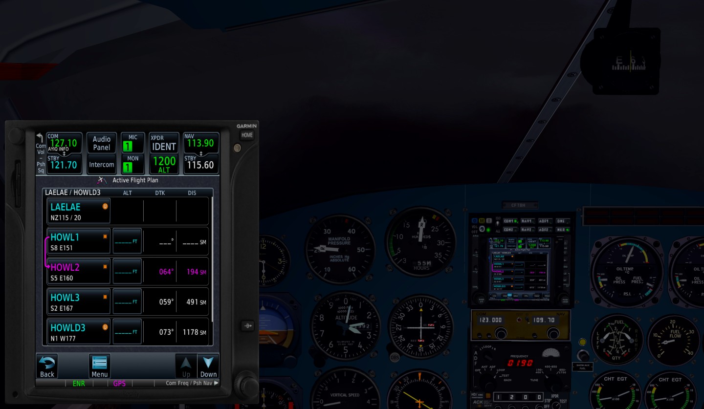
I purchased the GTN750 GPS from Reality XP to create flight plans. It allowed me to find and create a waypoint for Howland Island since there is no airstrip there anymore, only grass, so this was very helpful. I also created waypoints for other points where Noonan had Amelia make course adjustments to fly through valleys & avoid high mountain passes.
Lots of friends were made along the way who encouraged and helped me. Jim McNeill (known as Papa Mac) from Shade Tree Micro Aviation in Nevada and Ian Aldridge (encourager from Australia). Jim made several tweaks to the Beech 18 for me as well as customizing it to fit the GTN750 into the dashboard. That was a Godsend. Moreover, Jim and Ian took an interest in my flight and asked to be kept posted of my progress. Jim also gave me valuable written instructions on how to take off and land a tail dragger on short runways as well as lean the fuel mixtures for maximum mileage. Thanks Jim, I will always remember these tips.
X-Plane made a lot of changes to their program also as well. I was using version 11.4xx in Beta mode with all the incremental upgrades. The changes were very noticeable to the planes handling characteristics and appreciated very much. I also made a friend at X-Plane named Cristiano Maggi (Italy) who is working to install the Arch in St. Louis for me via a request I made on one of the recent open Forums presented. It will make Charles Lindbergh very happy. Cristiano also took an interest in this flight as well.
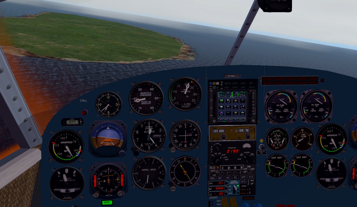
My older brother Steve encouraged me too. He has stood on the runway at Lae in Papau New Guinea before and had a little firsthand knowledge of the lay of the land. The actual airport Amelia used has been out of commission for years and has returned to grass and trees. I had to land at the new airport Lae Nadzab (AYNZ) then fly 10 miles south to the old Airstrip, land the plane and prepare for takeoff to Howland Island.
My wife Cindy was my biggest enthusiast and encouraged me to continue – especially when most of what I flew was at the end of a long day with her mother. It gave me an “Escape” out of the house for a while.
So… I enlisted Cindy to sit in on the last 45 minutes to Howland Island. We used the GPS to go the first 17 hours, then turned off all the maps and GPS for the end of the trip. We were at 10,000 ft before we started the descent as Fred Noonan needed to be in the cockpit at sunrise to get his final sunrise Sextant sighting to fine tune their position. Amelia required 65 miles to descend 10,000 ft. We made heading adjustments and dropped 9,000 ft below the clouds to just above the water at 1,000 ft. The sun was on our left as we turned onto the famous 157° – 337° line. We started at 157° flying south with the sun on our left. The clouds were casting shadows on the ocean and the shadows all looked like Howland Island. We flew the calculated time and distance we thought we needed but did not find Howland. We paused and turned on the GPS and saw that while we were flying parallel with Howland Island running down the line – we missed it by 15 miles. With the sun’s glare on our left, our visibility was reduced to just 9 miles thus we missed Howland by 6 miles. We could see 15 miles on our right, but only 9 miles to our left. The actual map Fred Noonan used was off by 6 miles which added to their predicament. Technically, we ran out of gas and they had to call out a search party for us. But we decided to save them money and bee lined it to the Island and landed manually. It was a moment of relief for us but. we could feel Amelia and Fred’s anguish what that must have been like for them.
The sights were fascinating and as we flew, we often saw the Pleiades constellation in front of us. One of the stars in this constellation is called Electra which is what Lockheed used to name their plane.
Thoughts of the last sunset, moonrise and sunrise Amelia and Fred would ever see were ever on my mind such that I thought I was right there with them. They truly had a lot of courage to try that Howland leg with the limited navigation skills they had at the time. I’m sure they would have brought along the GTN750 with them, but it wasn’t invented yet.
I was slow to learn how to save our flight using the “Situation” file. Instead I would put the computer into Hibernation and resume the flight when I moved the mouse again. One time I woke up to find the PC had awakened itself during the night and had continued the flight from Darwin Australia towards Papau New Guinea. It turned at a waypoint I created (to take their route of the lowest pass through the mountainous terrain) and was just a few miles from crashing into the mountains when I discovered the predicament. To be faithful with the recreation of the flight, I redid that leg since I was not in the cockpit with them.
Cindy & Randy Manley (retired pastor friend who married us) were with me on the final approach and landing starting just before the Golden Gate Bridge, past Alcatraz and into the Oakland Airport to much cheering and celebration.
Amelia’s notes from her round the world trip were published in a book written posthumously by her husband George Putnam and it was titled “Last Flight”. She said she only had one more Last Flight in her before embarking on this journey. Not me, this is kind of the beginning as I see it. My mind is prowling about thinking of all the endless possibilities where to go next since you can go anywhere in X-Plane. Again, on a retired budget how could you ever fly so far with the limited funds we have available. I look forward to all the upcoming changes coming to X-Plane in the future. It is all very exciting and I can’t wait to get started on the next adventure.
Finally, thanks to all my friends who cheered me on and looked forward to the updates I was periodically sending. They made it all the more fun.
The pictures I chose came from the last leg of the flight to Howland Island which I believe is what most people try to recreate. But only doing the last leg misses the whole trip as it becomes alive when you actually fly it (with them and your friends).
— Kitt Prible